
Walk a Lowell Street by Address
A useful Lowell address search begins with the Lowell map, not a name list. The City of Lowell assessor and GIS tools divide a street into parcels, then provide identifiers that can carry the search to the Lowell assessment card and deed index. That sequence distinguishes the owner of record from the parcel’s physical location and from an old Lowell directory occupant. It also prevents a mailing address from being mistaken for where a person lives.
- Enter the address, or browse a street range, in the Lowell city GIS viewer. Turn on parcels, addresses, and street centerlines so the correct Lowell parcel is clear.
- Open the Lowell parcel and save its Lowell GIS ID, account or parcel reference, property location, and the date of the search.
- Use the identifier in the Lowell assessor database to read the current owner, situs address, mailing address, sales history, and visible assessment fields.
- Search the current Lowell parcel owner as grantee in the Middlesex North Registry of Deeds, then copy the Lowell purchase deed’s legal description, plan reference, and seller.
- For a historic Lowell address, compare the deed trail with Lowell’s 1917-forward street listings. A narrowly described Lowell Election and Census request is the municipal route for public voter information, subject to protected-record exclusions.
Each step narrows the next one. A parcel ID connects current Lowell map work to the assessor, while a legal description and plan can bridge older Lowell deeds where a modern street number does not appear.
Lowell GIS Street and Parcel Fields
The Lowell Public GIS Viewer supports a Lowell street-oriented search rather than a household search. Its current Lowell GIS screen exposes address-range, street, owner-name, account or parcel, and GIS-ID inputs. Use the Lowell Street field with an address range to inspect a segment. Owner Name is a bridge to a Lowell property record, not proof that an owner occupies the parcel. The Lowell map themes add context such as zoning, flood, voting districts, aerial imagery, topography, and trash-day information.
| Viewer field | Input | Best use on a Lowell street | Limit |
|---|---|---|---|
| Address Range from/to | Optional text pair | Browse a Lowell segment without opening each number first | It identifies Lowell parcels, not occupants |
| Street | Optional text or dropdown | Set the named Lowell street and pair it with a range | Use current Lowell spelling and confirm older aliases |
| Owner Name | Optional text | Bridge a known Lowell owner to a parcel | Does not create a resident list |
| Account/Parcel or GIS ID | Optional text | Carry an exact Lowell map feature to the assessor card | Keep the Lowell identifier with the search date |
| Map theme and layers | Selector and checkboxes | Show Lowell parcels, addresses, centerlines, zoning, voting, or flood context | Lowell voting layers show geography, not names |
The Lowell public viewer is shown below with the Lowell street and parcel route used for a Lowell address search.
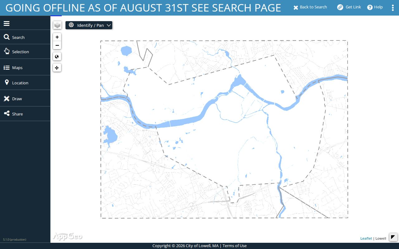
Read the selected Lowell feature against the Lowell assessor record before relying on an owner or mailing field. The Lowell GIS disclaimer says users must determine whether map information suits their purpose and verify it with the relevant department.
Lowell Street Directory Record Channels
A Lowell street search works best when each result is kept in its own lane. The Lowell assessor’s record card speaks to assessment and ownership fields; Lowell GIS explains parcel geography; the Lowell Registry carries recorded land instruments; and Lowell Development Services supplies address-based work history. Lowell Pollard Memorial Library adds the historical street-listing layer. None replaces the others, and each has an online, counter, or request route when the first search does not answer the question.
| Address record | Lowell custodian | What the record can show | Access route |
|---|---|---|---|
| Assessment and parcel card | City of Lowell Assessors | Owner, situs and mailing address, map or account fields, values, and sales | Vision database or assessor office verification |
| GIS parcel map | Lowell GIS | Lowell parcel geometry, address, nearby parcels, zoning, flood, and district context | Public viewer |
| Deed, mortgage, lien, or plan | Lowell’s Middlesex North Registry of Deeds | Parties, recording date, book or document reference, legal description, and image | Free land-record search, counter, and older-book paths |
| Permit or code material | Lowell Development Services | Address, owner or applicant information, work and inspection context when public | Limited online access, monthly reports, office, or records request |
| Street listings and maps | Lowell Pollard and partner collections | Historic Lowell occupants by number, building and street context | Physical copies, microfilm, selected scans, and library help |
Lowell Election and Census keeps municipal voter and resident records, but the statewide form is an individual status check that requires a name, complete date of birth, residential ZIP, and agreement checkbox. It is not a browseable street tool. A written request to the local custodian should state the desired street or ward, date range, fields, and format, and should ask that confidential and protected information be excluded.
Note: Record the Lowell source, search date, and identifier because Lowell parcel data, assessment years, and map layers can change.
Turn a Lowell GIS ID Into a Parcel Card
The Lowell Assessors link to the FY2026 Vision database, which the department says includes ownership details, parcel data, sales history, and assessment records. Its Lowell record-card guide labels Property Location, Vision ID, Account Number, Map ID, Building Number, State Use, and Print Date. Search a Lowell location, owner name, or available parcel reference, then compare the card with the Lowell GIS feature instead of treating one screen as the whole answer.
- Parcel
- A mapped piece of land used by the Lowell assessor. It is the map unit that connects an address to account and GIS identifiers.
- Situs address
- The physical Lowell location of the parcel. It can differ from the owner mailing address listed for tax correspondence.
- Legal description
- The Lowell deed’s land identity, often using lot, plan, book, page, or boundary language. It is safer than a current street number for older land records.
- Criss-cross directory
- A directory arrangement that starts with a street and number, then lists historic occupants or businesses. Lowell street listings begin in 1917.
Lowell requires owners to report changes to their mailing address through an Affidavit of Address. That makes a Lowell mailing field useful correspondence information yet it cannot prove physical occupancy. When an address is disputed, ask the Lowell assessor office to verify the assessment record rather than guessing from a map label.
Trace Lowell Streets Through Middlesex Deeds
The Middlesex North Registry of Deeds is the Lowell address trail’s land-record custodian. Its online Lowell land search offers recorded-land name, document, book, property, and date modes, plus pre-1976 grantor and grantee modes and unindexed pre-1855 books. Search a current Lowell owner as grantee, open the purchase instrument, and then search the seller as a prior grantee. Match legal descriptions, plan or lot references, and nearby parcels at every Lowell transfer.
Recorded-land search and image viewing are currently free, and the registry reports that printing and downloads are also free at this time. Images require pop-ups and Adobe Reader. If an older Lowell step fails online, the route changes rather than ends: use the pre-1976 index, the unindexed pre-1855 books, the Lowell registry counter, or staff assistance. The Registry is at 370 Jackson Street in Lowell and lists recording hours of Monday through Friday, 8:30 to 4.
Registry production history begins with handwritten books from 1855 through 1924, followed by typewritten, microfilm, scanned-print, and digital-only periods. Those production stages do not promise identical searchability. For a long street, process parcels one at a time, because the Registry does not provide an occupant-by-street result.
Lowell Permits as Street Evidence
Address-based permit material can clarify building work, inspection activity, or an older file request. Lowell Development Services says that its CSS search can use an address, owner name, or parcel ID. Search one field at a time, prefer the parcel ID, and enter address information in uppercase. Its online permitting availability is limited, and new construction or remodel and alteration applications must be filed in person. Older material may require a request to the department.
The Development Services page below identifies the permits and code-enforcement channels that can supplement a Lowell address search.
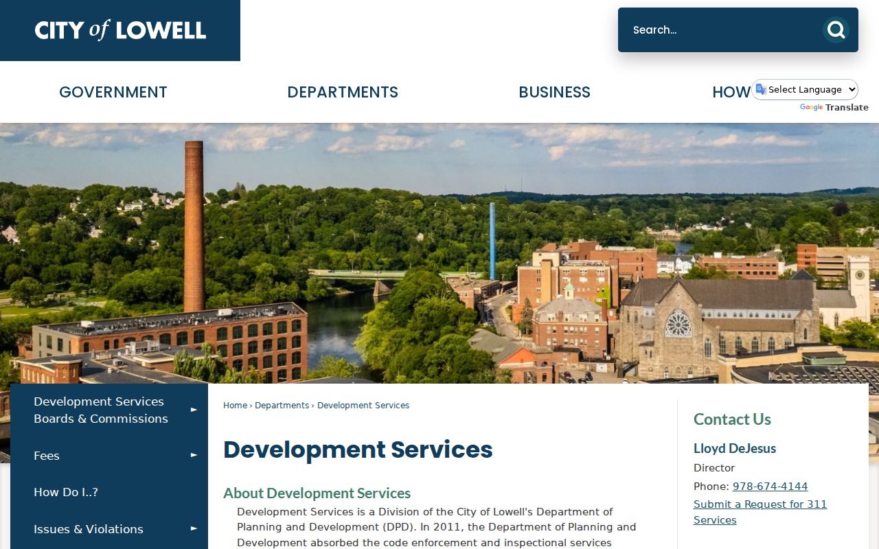
Monthly application reports cover permits issued during the prior two years. A permit or code entry is evidence about an address and a process. It is not a complete account of the people connected with that location. Development Services is at City Hall, 375 Merrimack Street, Room 55, and lists 978-674-4144 for its office.
Lowell Street Listings Since 1917
For a past address, the historical street section is the local record that matters most. Directory runs begin in 1832, but the address-first street listings begin in 1917. Pollard Memorial Library has early directories in physical copy and microfilm, while its local-history resources point to atlases, newspapers, yearbooks, the Center for Lowell History, and other collections. Compare an alphabetical entry with the street section and read the volume’s abbreviation key before assigning meaning to a mark or description.
The directory shelf is covered in more detail with collections and year runs on the Lowell city directories page. Here, use it as a date-stamped street tool: check adjacent numbers, compare a year before and after a change, and pair the result with an atlas, deed, or newspaper item. The 1879 and 1906 atlases, along with 1907 Sanborn material, can help date a building or identify lot context, but they do not prove that a particular family occupied it.
Names can vary across Lowell’s multilingual historical collections. Search accents, anglicized spellings, translated given names, and nearby years. Keep the original spelling in notes, especially when a directory uses a mill, boarding, parish, or company address rather than a modern residential format.
Lowell Streets That Need Name Checks
An address search can break when the street, city, or postal label changed. Lowell Code permits City Council street-name changes, and the Historic Board list records Hilton Street’s change to Sheraton Way on August 13, 1991. Historical material also mentions University Avenue as a former Moody Street name, but that lead should be confirmed against city street files before it is used as a one-to-one match. Maintain a note for each alternate street and the year in which it appears.
Pawtucketville’s 1874 annexation and the Wigginville-area change in 1905 create a second continuity issue. An address may appear in a suburban directory, deed town field, or census area before later being described as Lowell. Four geographic ZIPs and the PO-box-only 01853 are postal labels, not substitutes for parcel, ward, or historical municipal geography.
The legacy Lowell GIS search page remains useful for its familiar field labels and its migration notice.
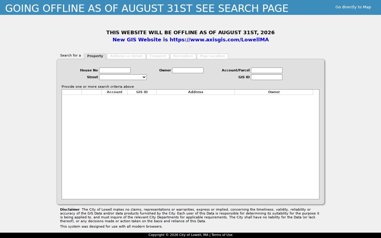
That page says it will go offline on August 31, 2026 and directs users to AxisGIS. Recheck the successor viewer’s fields and layers at the time of a new search, rather than assuming the legacy controls remain available.
What a Lowell Street Directory Leaves Out
Property, map, and deed records identify parcels and recorded parties, not everyone connected with an address. The statewide voter-status form is for an individual who supplies the required details, and confidential voter records, minors’ records, and protected addresses are withheld from public voter files. Motor-vehicle addresses, utility-customer information, and delivery data are not general public street records. Do not infer a household, a person’s presence, or a safety condition from an owner name or mapped parcel.
Lawful use. Use Lowell address records for lawful personal research, property history, and civic questions. Never use an address trail to stalk, harass, intimidate, or harm another person.
Lowell Street Directory Counter Routes
When a web search stops, use the custodian that owns the next record. The assessor can verify a card or property field. The Registry counter can help with older book, plan, or grantor-grantee paths. Development Services can route a records request for older permit files. Pollard Memorial Library, at 401 Merrimack Street, offers physical and microfilm historical resources, four microfiche readers, and a reference-request channel for questions that cannot be answered from a scan.
Massachusetts Public Records Law, M.G.L. c. 66, § 10, is the written-request fallback for existing public records. Name the record type, address or parcel, date range, requested format, and preferred delivery method, then ask for a fee estimate. The initial response is generally due within 10 business days. A narrow request is easier for the office to locate and review than an open-ended request for everything about a street.
Note: A well-kept address trail identifies its custodian and date, so a later researcher can verify each link.